The Field Boundary That Looks Older Than It Is
Learn how to read an old-looking field boundary without mistaking its hedge, bank or trees for proof of an unchanged ancient line.
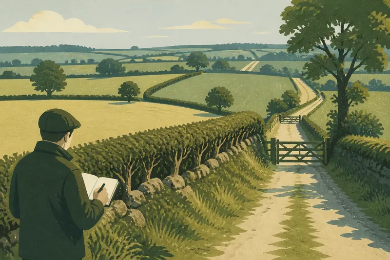
The common mistake when reading an old-looking field boundary is to treat its hedge or bank as a date stamp. That can turn a plausible clue into a confident but unsupported story: a boundary may look ancient while its present form is newer, altered or laid over an earlier line. Read the whole landscape before deciding what it means.
Appearance is not a date
A raised bank, mature hedge and scattered trees can suggest long use, but each feature has more than one possible history. A bank may have been built when a hedge was planted, reshaped during later maintenance, or formed gradually as soil and cuttings accumulated. A thick hedge can grow along a boundary that was moved, replanted or reworked.
Even the word “ancient” needs care. It might refer to the age of the route, the first division of the land, the planting of a hedge, or the age of the visible bank. Those are different claims. A line could have served as a boundary for a long time while its current hedge is comparatively recent.
Describe what you can see before assigning a date: “a low bank with a clipped hedge and mature trees” is stronger field language than “an ancient hedge”. Keep the interpretation separate from the observation.
Read the line in context
Start at a point where the boundary meets a lane, stream, building or another field edge. Look for changes in direction, gaps, bends and junctions. A line that connects naturally with other boundaries may be part of a wider pattern, but a neat connection does not by itself reveal when that pattern formed.
Notice what the boundary separates. Does it divide fields with different shapes, or does it run beside a track, drainage channel or change in slope? A hedge can follow a practical feature without being the original edge of a holding. Modern access, drainage or field management may also have altered its course.
Walk the line where access permits, but avoid crossing crops or entering private land without permission. From a public footpath or lane, compare the boundary’s visible character along its length. A uniform section may conceal repairs; abrupt changes in height, planting or direction can mark a later alteration rather than a single moment of creation.
Look for layered evidence
Hedges and banks are maintained structures, not sealed records. Cutting, laying, infilling, grazing pressure and gaps for gates can all change their appearance. A section with a broad base and uneven growth may have been managed differently from a narrow, recently replanted stretch, yet neither form supplies a reliable date on its own.
Trees deserve the same caution. A line of large trees can make a boundary feel settled and old, but the trees may have been planted after the boundary was established. Conversely, a long-used line may have few trees because they were removed, or because the boundary was kept low for visibility and access.
Look for physical relationships rather than isolated clues. Does a bank continue beneath a gateway, or does it appear to stop at a later opening? Does a hedge cross a ditch, or follow its edge? Such details can suggest sequences of change, but they should be recorded as questions to investigate, not converted into a date without supporting evidence.
Check maps and records
Historical maps can help track whether a boundary is shown in the same position at different points in time. Compare the line carefully with stable features such as roads, streams and farm buildings; map accuracy and the way a feature was drawn can vary. A map that shows a boundary establishes that it was recorded by then, not when it first came into use.
Current and older aerial images may reveal removed hedges, filled gaps or altered field shapes. Local archives, estate papers and parish records can add context, though a document may describe ownership or land use without explaining the physical boundary. Keep notes on each source and what it actually supports.
Say you see a raised bank beneath a mature hedge beside a public lane. An older map shows a line in roughly the same place, while a later image shows a gate widened through it. The sensible account is that the boundary was mapped by the earlier record and later altered at the entrance; the hedge’s exact age remains unestablished.
Separate observation from inference
Field notes are most useful when they preserve uncertainty. Record the location, direction, nearby landmarks and visible features, then mark possible explanations as possibilities. A simple sketch can show bends, gateways, ditches and changes in planting more clearly than a broad label such as “old boundary”.
- Bank: note where it rises, falls or disappears.
- Hedge: describe whether it is dense, gappy, laid or recently replanted.
- Boundary ends: record how the line meets roads, watercourses and other field edges.
- Alterations: mark gateways, tracks, drainage cuts and abrupt changes in form.
- Sources: note the map or record consulted and the date it depicts, if known.
Use cautious wording in descriptions. “Possibly follows an earlier line” leaves room for evidence; “marks the original estate boundary” makes a larger claim that needs stronger support.
Questions at the field edge?
Does a thick hedge prove an ancient boundary?
No. Thickness reflects growth and management as well as age, and a hedge may have been replanted along an established line. Treat it as a feature to describe, not a clock.
Can a bank reveal when it was built?
Its shape may help identify construction or later modification, but appearance alone rarely gives a secure date. Compare its relationships with nearby features and consult documentary evidence where available.
What does an old map establish?
It can show that a boundary was represented at the time the map was made. It does not, by itself, show when the line began or whether the hedge and bank then looked as they do now.
How should an uncertain line be described?
Record observable details first, then use qualified language for interpretation. Distinguish a boundary’s documented presence from guesses about its origin or uninterrupted use.
Leave room for change
A field boundary can carry several histories at once: an old route, a later bank, a replanted hedge and a recent gateway. The most useful reading does not force those layers into one date. It says what is visible, identifies what records support, and leaves unresolved questions open.
When you next pass an old-looking hedge, note one junction or change in form before calling it ancient. That small pause makes the account of the landscape more accurate—and gives the next observer something specific to check.